The Blackwater
The Rio Negro Project will involve traversing the largest black water river on the planet through the largest Rainforest on the planet. The river crisscrosses through three countries and three troubled border regions. These consist of Colombia, Brazil and Venezuela. The borders are porous in nature and wild by location. The region consists primarily of indigenous people from several tribes notably the Puinave people amongst many more.
Key Facts
- One of the Largest Blackwater Rivers: The Rio Negro, located in South America, is the largest blackwater river in the world. "Blackwater" describes the dark colour of the water, which results from decaying plant matter releasing tannins into the water.
- Significant Tributary of the Amazon: The Rio Negro is the largest left tributary of the Amazon River, the second-longest river in the world. At their confluence near Manaus, Brazil, the stark colour contrast between the Amazon's lighter waters and the Rio Negro's dark waters creates an impressive sight.
- Vast Archipelago System: The Rio Negro is also home to the Anavilhanas Archipelago, the largest river archipelago in the world. This sprawling archipelago stretches across more than 350 kilometres, featuring approximately 400 islands and numerous lakes, channels, and sandbars. This area is rich in biodiversity, hosting a multitude of animal and plant species.
- Remarkable Biodiversity: The regions around the Rio Negro, including the Amazon Rainforest, are home to a stunningly diverse array of species. Many unique and endangered species can be found here, such as the Amazon river dolphin, the black caiman, and countless species of birds and fish.
- Climate Extremes: The Rio Negro can experience extreme shifts in water levels due to the region's heavy rainfall during the wet season and droughts during the dry season. In some years, the river's water levels can fluctuate by as much as 14 meters (about 46 feet), significantly impacting the river's course and surrounding ecosystems.
About Expedition
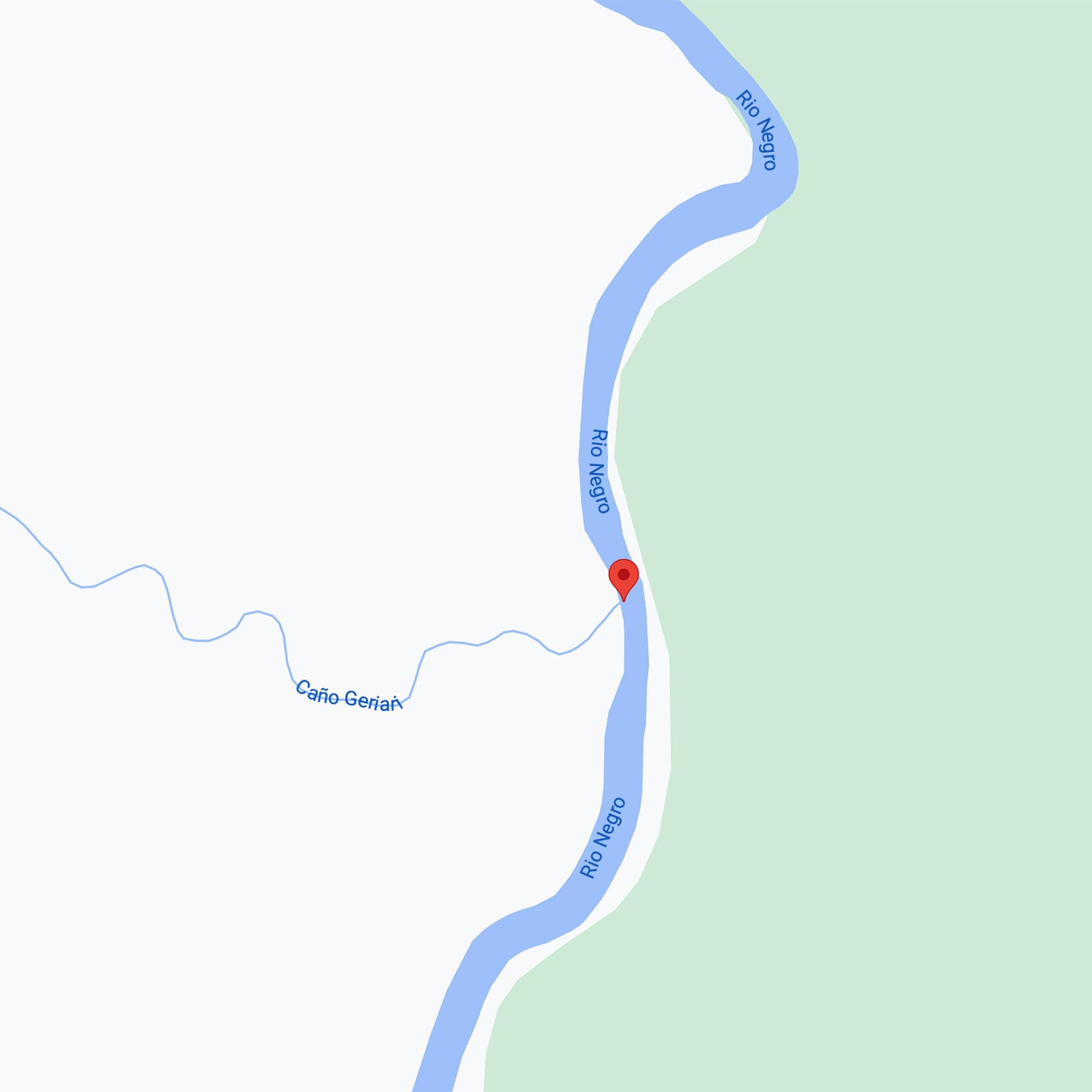
The expedition within Colombia will be solely in Guainia which translates to land of many waters similar to that of The country Guyana. When the expedition is within Colombia it will pass through one of the few national parks that are not open to eco-tourism and the capital of the department is Inirida. Which getting there is a 2 hour flight in Colombia from Bogota, from this point it is around 6 days on boat to get to the beginning of the Rio Negro. An expedition in itself.
The Rio Negro then is a whole new challenge, it is over 1400 miles long with its widest point in brazil at around 18 miles wide that is based around the Anavilhanas National Park and has never been wholly travelled and documented which is what I intend to do. The beginning of the trip will be at the coordinates 2°11'57.3"N 69°31'54.4"W and end in the city of Manaus. The highlight, I think, of the expedition would be travelling through the national park known as Reserve Nacional Natural Puinawai, currently closed and having always been closed, there is next to no information about how to get there which is in itself a huge draw for me. There will be a number of spread out communities: Loro, Marinuma, Pareza and Guarinuma. These are the ones that show up on Google Maps. So the unknown communities will be a surprise to me on this leg of the expedition.
The Rio Negro then is a whole new challenge, it is over 1400 miles long with its widest point in brazil at around 18 miles wide that is based around the Anavilhanas National Park and has never been wholly travelled and documented which is what I intend to do. The beginning of the trip will be at the coordinates 2°11'57.3"N 69°31'54.4"W and end in the city of Manaus. The highlight, I think, of the expedition would be travelling through the national park known as Reserve Nacional Natural Puinawai, currently closed and having always been closed, there is next to no information about how to get there which is in itself a huge draw for me. There will be a number of spread out communities: Loro, Marinuma, Pareza and Guarinuma. These are the ones that show up on Google Maps. So the unknown communities will be a surprise to me on this leg of the expedition.
Canoes
The Plan
My expedition down the Rio Negro will begin at the coordinates 2°11'57.3"N 69°31'54.4"W which in itself is extremely hard to get to so the travelling will begin from Inirida with a flight from Bogota to Inirida, and I will meet with a local community member where I will be travelling for 6 days to begin up-river to the start point near the Loro community where I have got to acquire a traditional canoe which will be the principal form of travel along. At times the expedition will see me create a path through untouched parts of primary rainforest. This will create its own dangers typical of the South American Jungles. The plan will be supported by local communities which will begin with the Puinave people. The river flows through three countries and three border regions, which also come with its own problems and South America's porous border regions. As the expedition down the Rio Negro will take 2 – 3 months if all works out well, it will be in the wettest months of December which swells the river immensely and navigation and know-how will have to be paramount.
The Means
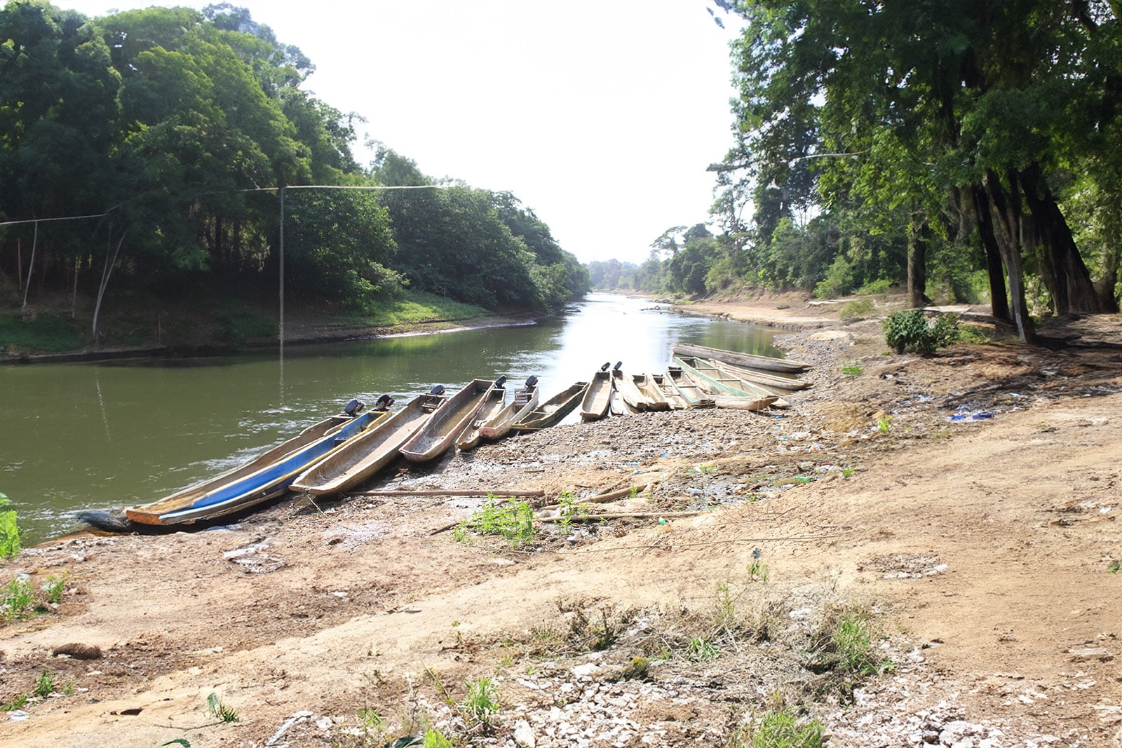
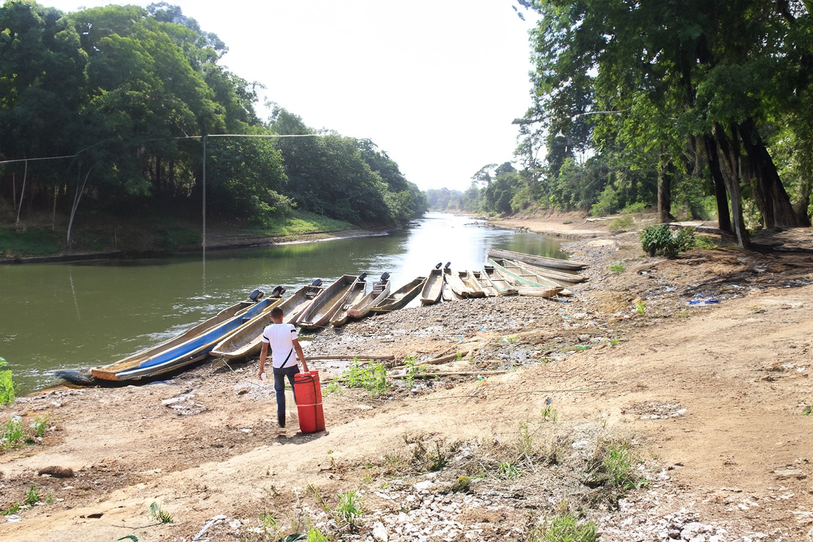
So as we can see by the image, there are no typical or standard dugout canoes but all serve an essential purpose transporting people and goods in regions with no road access. Some have been fitted with outboard motors and some will have a paddle inside them, typical of light wood that floats. Commonly this is crabwood which is the go-to paddle material in latin America. My aim will be to find the lightest, smallest canoe available as some could weigh more than I could drag through the woodland. On a previous trip in the past it was needed on more than one occasion.